

Deforestation forecast maps
| Map | Metadata | File | Thumbnail |
|---|---|---|---|
| Map of the probability of deforestation for Madagascar for the year 2010 | GeoTIFF raster file, 154.1 Mo, EPSG: 32738, 30m resolution, UInt16, probabilities rescaled from [0,1000000] to [1,65535] | prob2010.tif | 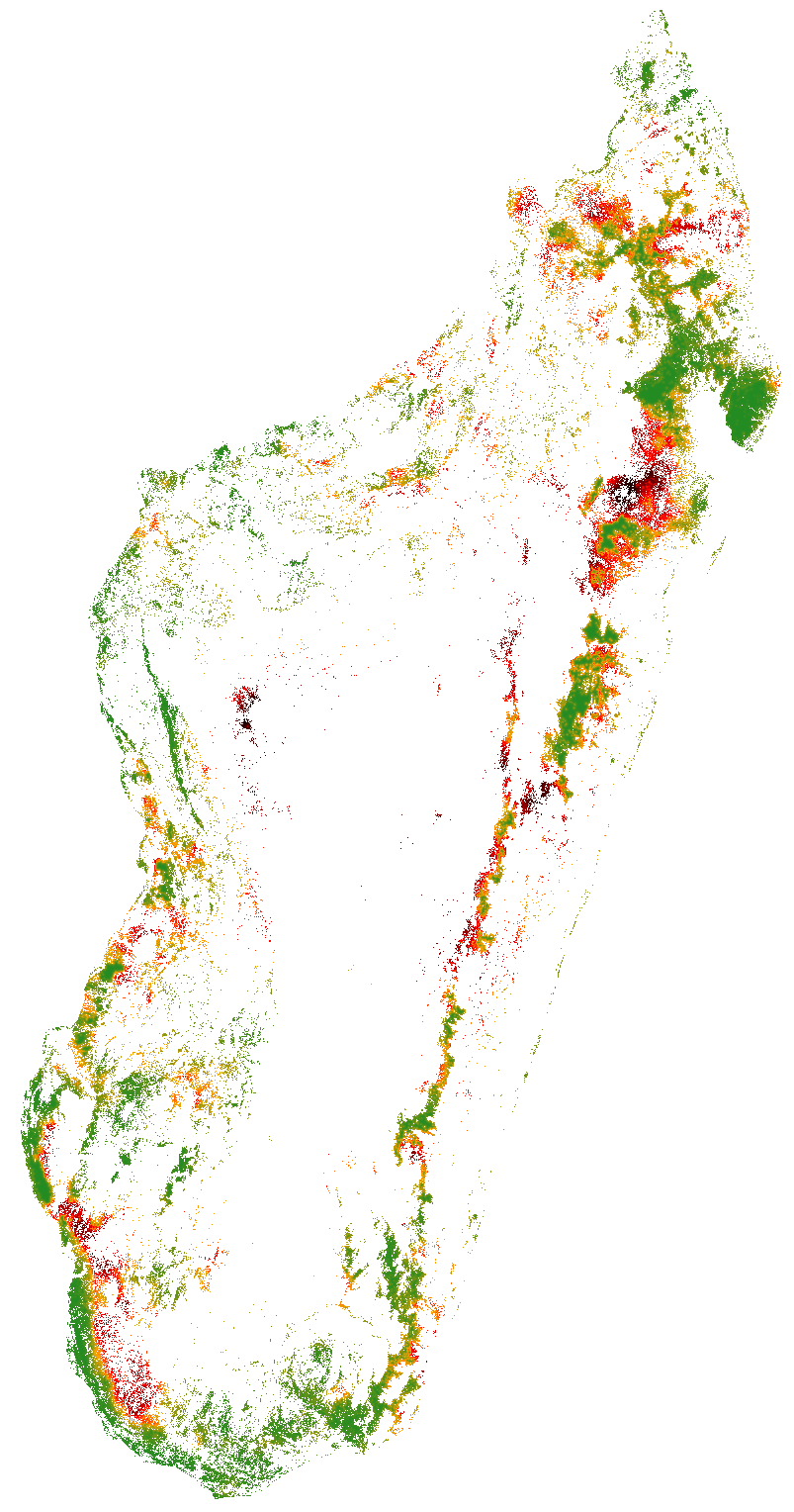 |
Forest maps
| Map | Metadata | File | Thumbnail |
|---|---|---|---|
| National forest map for Madagascar for the year 2014 | GeoTIFF raster file, 30.4 Mo, EPSG: 32738, 30m resolution, Byte | for2014.tif | 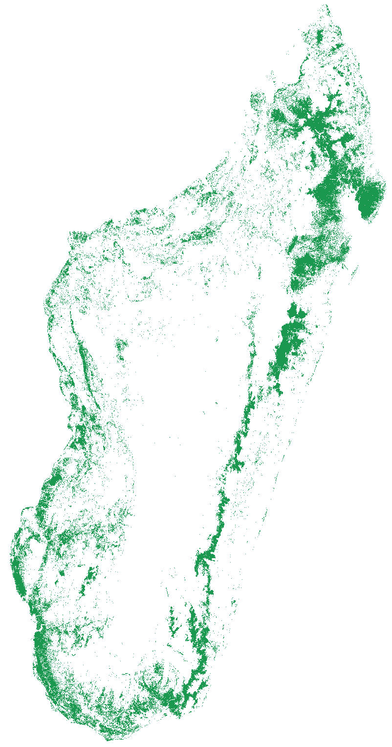 |
| National forest map for Madagascar for the year 2010 | GeoTIFF raster file, 29.3 Mo, EPSG: 32738, 30m resolution, Byte | for2010.tif | 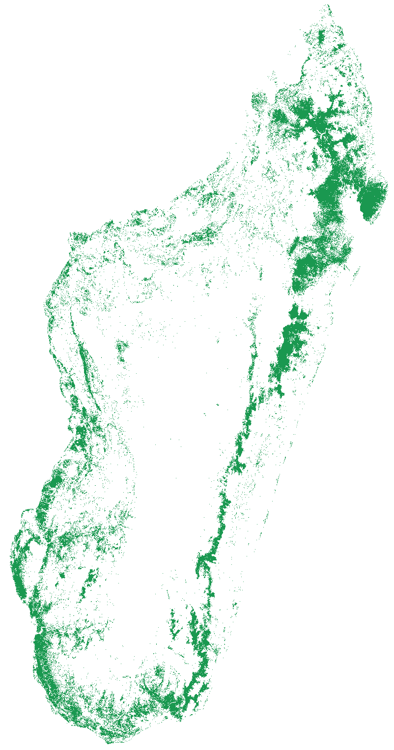 |
| National forest map for Madagascar for the year 2005 | GeoTIFF raster file, 28.3 Mo, EPSG: 32738, 30m resolution, Byte | for2005.tif | |
| National forest map for Madagascar for the year 2000 | GeoTIFF raster file, 27.4 Mo, EPSG: 32738, 30m resolution, Byte | for2000.tif |  |
| National forest map for Madagascar for the year 1990 | GeoTIFF raster file, 28.1 Mo, EPSG: 32738, 30m resolution, Byte | for1990.tif | 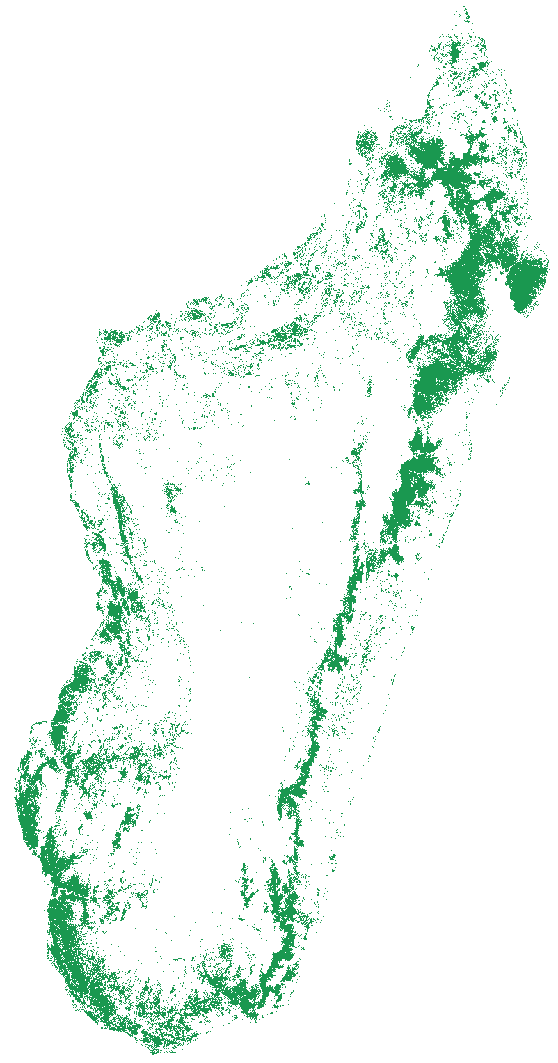 |
| National forest map for Madagascar circa 1973 | GeoTIFF raster file, 35.5 Mo, EPSG: 32738, 30m resolution, Byte, Code: 1=forest 5=cloud | for1973.tif | 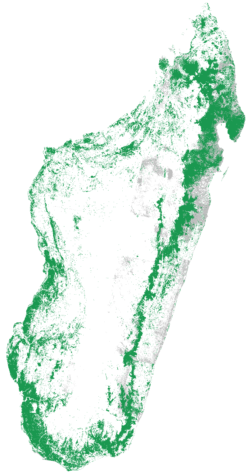 |
| National forest map for Madagascar circa 1953 | GeoTIFF raster file, 17.5 Mo, EPSG: 32738, 30m resolution, Byte | for1953.tif |  |
Historical deforestation in Madagascar

Carbon maps
| Description | Metadata | File | Thumbnail |
|---|---|---|---|
| National forest carbon map for Madagascar for the year 2010 | GeoTIFF raster file, 4.2 Mo, EPSG: 32738, 250m resolution, Int16 | ACD_for10.tif |  |
| National carbon map for Madagascar for the year 2010 | GeoTIFF raster file, 12.4 Mo, EPSG: 32738, 250m resolution, Int16 | ACD_RF_2010.tif | 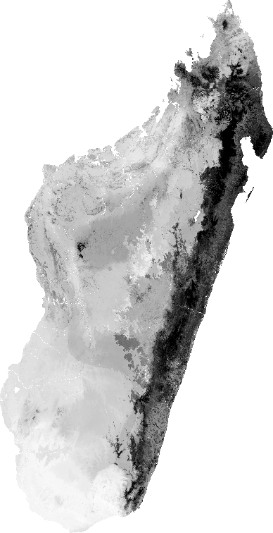 |
| Random Forests model used to derive the national forest carbon map | R data file (.rda), 3.3 Mo | RFmodel.rda |  |
| R script used to derive the national forest carbon map | R script file (.R), 47 Ko | Rscript_carbon.R |  |
| ACD data used to derive the national forest carbon map | KML file (.kml), 2.2 Mo | ACD.kml | 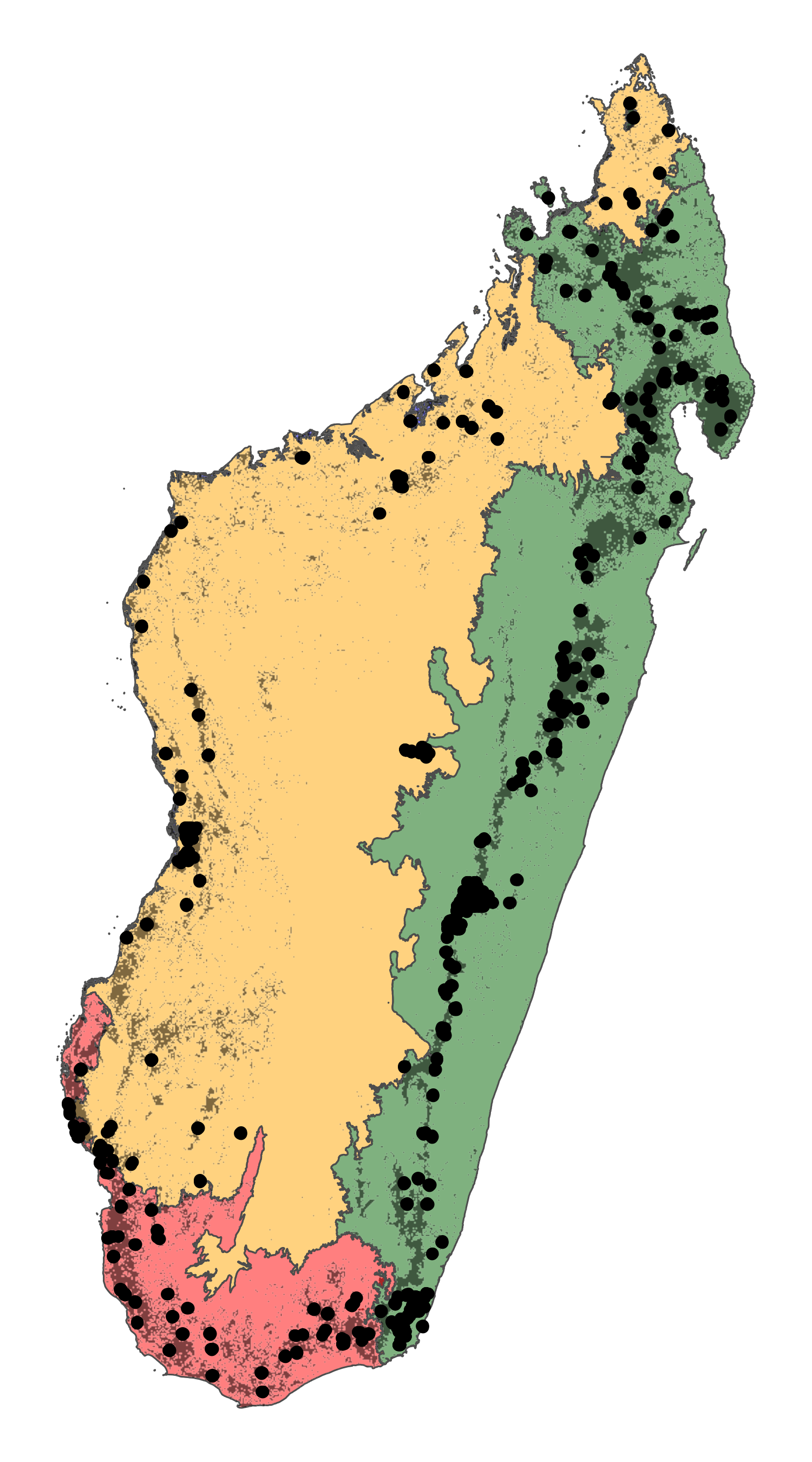 |